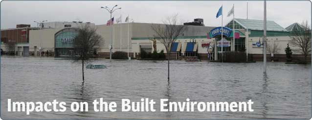
Photo Credit: RI DOT
If We Build It, They Will...What?
Giving human beings credit where it is due, when we build a structure, we usually intend it to be permanent, at least within reason. But when we build things to last, we hopefully have an eye to what may become of the surrounding environment. That has not necessarily been the case in the past. Given the current and anticipated impacts of climate change, considering the effects of such changes must be central in planning for the future.
The types of structures likely to be impacted range from seemingly obvious things, such as sea walls and jetties, to less obvious but still critically important buildings and infrastructure. Vital infrastructure components like sewage treatment plants (pdf), dams (pdf), and roads and railroad lines are also vulnerable to climate change impacts. In Superstorm Sandy, the vulnerability of the NYC subway system was both evident and crippling.
These impacts are felt in both coastal and inland areas. Sea level rise and increased storminess are likely to threaten coastal infrastructure, while increased flooding could affect inland infrastructure.
Climate change and its impacts are looming, so it is time to start planning ahead, especially when we start thinking about “permanent” structures such as roads and bridges. Sea level rise, erosion, and flooding from high intensity storms have already done damage to parts of Rhode Island’s infrastructure, and future impacts are likely to be worse. The game is far from over.
National Flood Insurance Program
In Rhode Island state agencies and communities have identified infrastructure vulnerabilities in their hazard mitigation plans. They have also identified the number of structures that qualify for National Flood Program Insurance by their location:
- 360,362 structures are in the floodplain
- 12,606 policies are for structures in A zones*
- 2,044 policies are for structures in V zones**
- 10,329 policies are in the X or 500-year flood zones***
*AE, A, or AO Zone - These properties have a 1 percent chance of flooding in any year, and a 26 percent chance of flooding over the life of a 30-year mortgage.
**VE or V Zone - These properties have a 1 percent chance of flooding in any year and also face hazards associated with coastal storm waves.
***X Zone - These properties are in an area of overall lower risk.
“Homes and buildings, many of which are old and drafty, eat up 40 percent of the energy America uses. Such inefficiencies perpetuate our reliance on foreign oil, imperiling our national security and increasing our contribution to climate change.”
– Peter Welch
News
“Tourists Are Flocking to Locations Threatened by Climate Change. That Only Makes Things Worse.” Vox
Factoids
Rising sea levels contribute to the net loss of shoreline, and threaten structures and infrastructure.
Sea level rise is expected to accelerate in the coming years as atmospheric temperatures continue to increase. There is about $4 billion worth of development on the waterfronts in Providence, East Providence and Pawtucket, and much of it would be under water if the projections hold up.
100% of Rhode Island’s population lives in a county with coastline, and the coastline population density is above 1,000 people per square mile.
Over 130 miles of the Narragansett Bay estuary are “hardened” (e.g., bulkheads, piers, revetments, seawalls), which accounts for one quarter of the shoreline.


